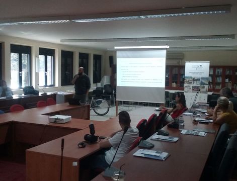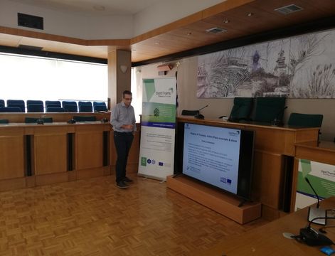
After the destructions of the 2009 earthquake, L'Aquila and its surroundings are in the course of reconstructing and reorganizing their public transport network. The use of ICT in Intelligent Transportation systems was in the focus of the 3rd Thematic Workshop of the OptiTrans project in L'Aquila on 18-19 April 2018.
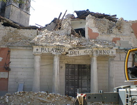
On the 6th of April 2009, an earthquake with a magnitude of 6.3MW and a hypocentral depth of 10 km struck the Italian city of L’Aquila (population 72,800). L’Aquila is the capital of the namesake province and the administrative capital of the Abruzzo region in central Italy.
To create new living spaces for displaced citizens, two different strategies of relocation were enacted: small settlements, called Moduli Abitativi Provvisori (Temporary Housing Prefabs) (MAPs), were established and large new towns were constructed around L’Aquila in the framework of the Complessi Anti-Sismici Eco-compatibili (CASE) Project (Earthquake-proof Eco-compatible Housing Complexes).
This housing solution, however, presented problems in terms of lack of basic services, including sewage, pharmacies, post offices, supermarkets, schools, churches, social and sports centers, and public transport (low and at unreliable frequencies).
As a result of the earthquake, some initiatives have been carried out regarding the creation of innovative infomobility services.

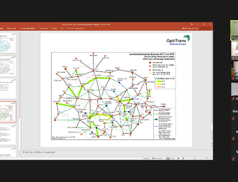
First of all, an agreement was signed with the University of L'Aquila and the local public transport company (AMA) for the realization of a study to optimize the urban public transport service, whose first objective was to study the new request of service by users. Therefore, mathematical models were validated to provide the public transport company with proposals to modify the existing exercise in order to get closer to user requests.
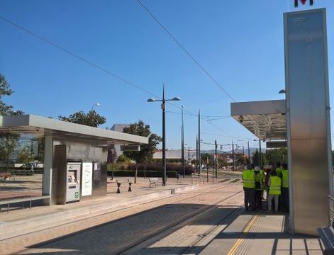
Subsequently, the University developed an innovative platform for infomobility and for the management of the public transport service called "Bus on Air" which was able to provide users, via a mobile application, with information on timetables and routes, allowing in the most advanced version to perform a real-time tracking of the vehicles and to schedule timetables in order to take into account any delays or disruptions.
An architecture of the infomobility divided into 3 modules was prepared: one to manage information about the transport service in real time; the other to make this information available through websites, responsive web services and mobile apps; and finally the possibility to make available the data of the applications in open format for any third-party developers.
With regard to the public transport system, the infostructure approach guided the working group for the infomobility towards the choice, development, and production of new digital tools, data, and information (GTFS open source editor, web-based trip planner, GTFS data and geo-referencing of public transport information such as bus stops and lines) that were never available before in L’Aquila and that would improve access to the public transport service for citizens (see Enzo Falco, Ivano Malavolta, Adam Radzimski, Stefano Ruberto, Ludovico Iovino & Francesco Gallo (2017): Smart City L’Aquila: An Application of the “Infostructure” Approach to Public Urban Mobility in a Post-Disaster Context, Journal of Urban Technology).
The GTFS has allowed the working group for the infomobility to develop a database with an innovative graph structure that has allowed us to create an internal representation of the data and indexes so as to be able to realize more efficient management algorithms than those normally available on the market.
Sharing the full GTFS on open repositories was also essential for involving the community of developers and improving transit data.
Cover photo by Insilvis~commonswiki at wikipedia.org